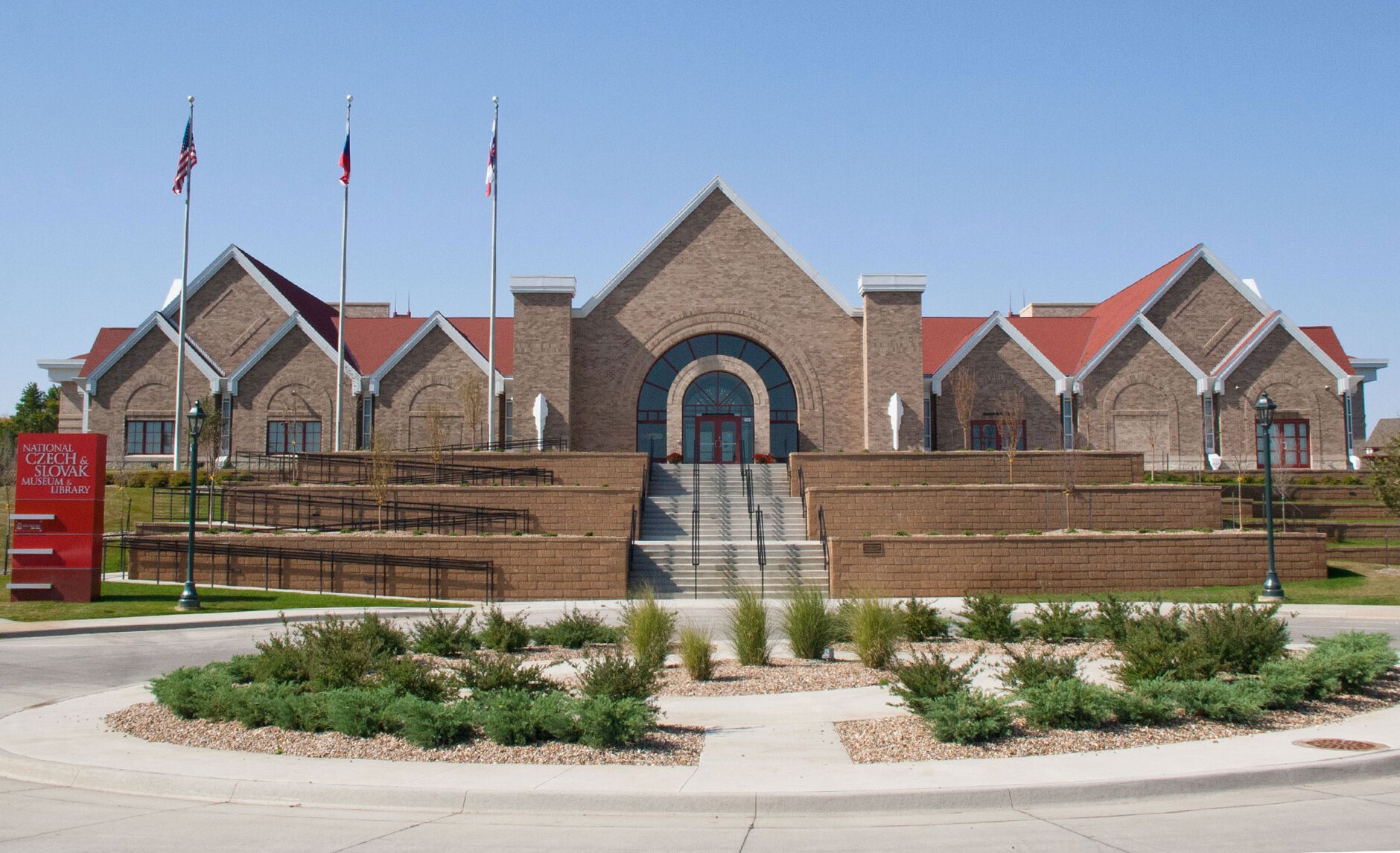
National Czech & Slovak Museum & Library in Cedar Rapids

Outdoors

Fishing near Cedar Rapids

Lakes, rivers and recreation areas near Cedar Rapids where fishing is allowed, closest first.

30places to fish
11 mito the closest
8within 30 miles

Good to know: Anyone 16 or older generally needs a state fishing license; seasons, limits and special rules vary by water. Iowa license information ↗

Closest picks

1

Sandy Beach Camp

11 mi southeast · US Army Corps of Engineers

The Sandy Beach Cammpground is located on the northern shores of Coralville Lake. The Coralville Lake Project is a multiple use project providing primary benefits in flood control and low flow augmentation, and secondary benefits in…

2

Sugar Bottom Day Use Area

15 mi southeast · US Army Corps of Engineers

Sugar Bottom Day Use Area is a day-use facility located on the shore of Coralville Lake.

3

Sugar Bottom Campground

16 mi southeast · US Army Corps of Engineers

The Sugar Bottom Campground is located on the shores of Coralville Lake. The Coralville Lake Project is a multipule use project providing primary benefits in flood control and low flow augmentation, and secondary benefits in recreation,…

Map of all 30 places

Map of 30 places loads as you scroll.

Within 30 miles (8)

11 mi southeast · US Army Corps of Engineers · Campground

Sandy Beach Camp

The Sandy Beach Cammpground is located on the northern shores of Coralville Lake. The Coralville Lake Project is a multiple use project providing primary benefits in flood control and low flow augmentation, and secondary benefits in…

  • Boating
  • Camping
  • Fishing

15 mi southeast · US Army Corps of Engineers · Campground

Sugar Bottom Day Use Area

Sugar Bottom Day Use Area is a day-use facility located on the shore of Coralville Lake.

  • Camping
  • Disc Golf
  • Fishing
  • Hiking
  • Mountain Biking
  • Picnicking
  • Swimming
  • Water Access

16 mi southeast · US Army Corps of Engineers · Campground

Sugar Bottom Campground

The Sugar Bottom Campground is located on the shores of Coralville Lake. The Coralville Lake Project is a multipule use project providing primary benefits in flood control and low flow augmentation, and secondary benefits in recreation,…

  • Biking
  • Camping
  • Fishing
  • Hiking

18 mi southeast · US Army Corps of Engineers

Coralville Lake

Coralville Lake is a multiple use project providing primary benefits in flood control and low flow augmentation, and secondary benefits in recreation, fish and wildlife management, forest management and water quality improvement.

  • Biking
  • Boating
  • Camping
  • Fishing
  • Hiking
  • History
  • Nature education
  • Off-highway vehicles

18 mi southeast · US Army Corps of Engineers · Campground

Tailwater East Campground

The Tailwater East Campground is located within the Dam Complex at the Coralville Lake Project.

  • Biking
  • Boating
  • Camping
  • Fishing
  • Hiking
  • Wildlife viewing

18 mi southeast · US Army Corps of Engineers · Campground

Tailwater West Campground

The Tailwater West Campground is located within the Dam Complex at the Coralville Lake Project.

  • Biking
  • Boating
  • Camping
  • Disc Golf
  • Fishing
  • Hiking
  • Water Activities

18 mi southeast · US Army Corps of Engineers · Campground

Tailwater West Day Use Area

Tailwater West Day Use Area is a day-use facility located along the tailwaters of the Coralville Lake Dam.

  • Camping
  • Fishing
  • Hiking
  • Picnicking
  • Water Access
  • Wildlife viewing

18 mi southeast · US Army Corps of Engineers · Campground

West Overlook Campground

The West Overlook Campground is located within the Dam Complex at the Coralville Lake Project.

  • Biking
  • Boating
  • Camping
  • Fishing
  • Hiking
  • Swimming
  • Water Access
  • Water Activities

30 to 75 miles (9)

53 mi southeast · US Army Corps of Engineers · Campground

Blanchard Island Recreation Area

The Mississippi River Project’s Muscatine Ranger Station has gone to a new way to pay for First-Come First-Serve campsites at the Blanchard Island Recreation Area. This new way is called "Scan & Pay".

  • Birding
  • Boating
  • Camping
  • Fishing
  • Water Access

55 mi southeast · US Army Corps of Engineers · Campground

Shady Creek

Shady Creek Campground is a 22-acre park where campers enjoy getaways on the banks of the Mississippi River. A nature trail, shore fishing and fantastic bird watching are offered at Shady Creek.

  • Boating
  • Camping
  • Fishing
  • Hiking

57 mi southeast · US Army Corps of Engineers · Campground

Clarks Ferry

Clarks Ferry is a outdoor lovers delight, with fantastic bird watching and lots of shore fishing opportunities with our new accessible fishing dock!

  • Birding
  • Boating
  • Camping
  • Fishing

59 mi southeast · Fish and Wildlife Service

Port Louisa National Wildlife Refuge

The 24,149 acre Port Louisa National Wildlife Refuge was established for the protection of migratory birds and other wildlife. Although the U.S.

  • Archery
  • Backpacking
  • Biking
  • Birding
  • Boating
  • Fishing
  • Hiking
  • Hunting

64 mi northeast · US Army Corps of Engineers

Mississippi River - Pool 10

Located within the scenic Upper Mississippi River Valley between Lynxville, WI. and Guttenberg, IA.

  • Boating
  • Fishing
  • History
  • Hotel/Lodge/Resort Privately Owned
  • Picnicking
  • Water sports
  • Wildlife viewing

67 mi northeast · US Army Corps of Engineers

Mississippi River - Pools 11-22

Fifteen campgrounds dot the shoreline along the upper Mississippi River Project. Facilities include campsites, boat ramps, picnic shelters, interpretive programs, hiking trails and eagle watching in the winter months.

  • Biking
  • Boating
  • Camping
  • Fishing
  • Hiking
  • Hotel/Lodge/Resort Privately Owned
  • Picnicking
  • Water sports

69 mi east · US Army Corps of Engineers · Campground

Blanding Landing

Blanding Landing is situated in a lush river valley on the east bank of the great Mississippi, just 13 miles from Galena, Illinois. Rich deposits of minerals line the landscape.

  • Birding
  • Camping
  • Fishing
  • Picnicking
  • Water Access
  • Wildlife viewing

69 mi northeast · US Army Corps of Engineers · Campground

Grant River

Spread along the banks of the Upper Mississippi River, the Grant River Campground, located in the "Catfish Capital of Wisconsin," is a modern campground that offers a plethora of outdoor and recreational activities.

  • Birding
  • Camping
  • Evening Programs
  • Fishing
  • Picnicking
  • Water Access

72 mi east · US Army Corps of Engineers · Campground

Fishermans Corner

With impressive views of the mighty Mississippi River, Fishermans Corner provides convenient RV and tent camping facilities for outdoor enthusiasts.

  • Biking
  • Camping
  • Fishing

75 miles and farther (13)

77 mi east · US Army Corps of Engineers · Campground

Bulger's Hollow Recreation Area

Bulger's Hollow Recreation Area is a hidden gem located on the Mississippi River. Whether you like camping, fishing, boating, or just taking in nature, Bulger's Hollow Recreation Area is the perfect place.

  • Birding
  • Boating
  • Camping
  • Canoeing
  • Fishing
  • Kayaking
  • Paddling
  • Picnicking

78 mi southwest · US Army Corps of Engineers · Campground

North Overlook Camp

North Overlook Campground is located on Lake Red Rock, Iowa's largest lake. It is just 10 minutes from Pella, known for its Dutch heritage, and 15 minutes from Knoxville, the Sprint car capital of the world.

  • Biking
  • Boating
  • Camping
  • Fishing
  • Hiking
  • Swimming

78 mi southwest · US Army Corps of Engineers · Campground

Wallashuck

Wallashuck Campground is located on Lake Red Rock, Iowa’s largest lake. It is just 10 minutes from Pella, known for its Dutch heritage, and 15 minutes from Knoxville, the Sprint car capital of the world.

  • Biking
  • Boating
  • Camping
  • Fishing
  • Hiking

79 mi southwest · US Army Corps of Engineers · Campground

Howell Station

Howell Station Campground sits just below the Red Rock Dam and Lake on the north side of the Des Moines River.

  • Biking
  • Boating
  • Camping
  • Fishing
  • Hiking
  • Wildlife viewing

79 mi southwest · US Army Corps of Engineers

Lake Red Rock

Lake Red Rock is Iowa's largest lake and is just 10 minutes from Pella, known for its Dutch heritage and 15 minutes from Knoxville, Sprintcar Capital of the World.

  • Biking
  • Boating
  • Camping
  • Fishing
  • Hiking
  • Horseback riding
  • Hotel/Lodge/Resort Privately Owned
  • Nature education

81 mi north · Fish and Wildlife Service

Driftless Area National Wildlife Refuge

Driftless Area National Wildlife Refuge was established in 1989 under the authority of the Endangered Species Act of 1973. Two federally listed endangered species, the Iowa Pleistocene snail and northern monkshood, are found on the refuge.

  • Archery
  • Birding
  • Boating
  • Fishing
  • Hiking
  • Hunting
  • Photography
  • Wildlife viewing

87 mi west · Fish and Wildlife Service

Neal Smith National Wildlife Refuge

Neal Smith National Wildlife Refuge was established in 1990 with the mission to actively protect, restore, reconstruct and manage the diverse native ecosystems of tallgrass prairie, oak savanna and sedge meadow.

  • Biking
  • Birding
  • Cross Country Skiing
  • Educational Programs
  • Fishing
  • Hiking
  • Hunting
  • Photography

91 mi north · US Army Corps of Engineers

Mississippi River - Pool 9

Located within the scenic Upper Mississippi River Valley between Genoa, WI and Lynxville, WI.

  • Boating
  • Camping
  • Fishing
  • Picnicking
  • Water sports
  • Wildlife viewing

100 mi southwest · US Army Corps of Engineers

Rathbun Lake

Over 700 campsites are available at this 11,000-acre lake in the rolling hills of southern Iowa. Excellent camping, fishing, hunting, boating, state fish hatchery, and Honey Creek Resort, are major attractions.

  • Biking
  • Boating
  • Camping
  • Fishing
  • Hiking
  • History
  • Hotel/Lodge/Resort Privately Owned
  • Nature education

105 mi west · US Army Corps of Engineers

Saylorville Lake

The Saylorville Lake Project is 26,000 acres, which stretches for over 50 miles up the Des Moines River Valley.

  • Boating
  • Camping
  • Fishing
  • Hiking
  • Horseback riding
  • Nature education
  • Picnicking
  • Water sports

114 mi north · US Army Corps of Engineers

Mississippi River - Pool 8

Located within the scenic Upper Mississippi River Valley between Dresbach, MN and Genoa, WI.

  • Boating
  • Camping
  • Fishing
  • Picnicking
  • Water sports
  • Wildlife viewing

133 mi north · US Army Corps of Engineers

Mississippi River - Pool 7

Located within the scenic Upper Mississippi River Valley between Trempealeau, WI and Dresbach, MN.

  • Boating
  • Fishing
  • Picnicking
  • Water sports
  • Wildlife viewing

134 mi south · Fish and Wildlife Service

Great River National Wildlife Refuge

What is now known as Great River National Wildlife Refuge began in 1958 as part of Mark Twain National Wildlife Refuge, a sprawling refuge which included units along the Mississippi River in Iowa, Missouri and Illinois.

  • Archery
  • Birding
  • Boating
  • Fishing
  • Hiking
  • Hunting
  • Motor Boat
  • Nature education

Distances are straight-line miles from downtown Cedar Rapids. Listings come from Recreation.gov’s federal recreation database; check each official page for hours, fees, fire restrictions and closures before you go.

Get outside around Cedar Rapids

More outdoors near Cedar Rapids

Questions

Where is the closest place for fishing near Cedar Rapids?

Sandy Beach Camp (US Army Corps of Engineers), about 11 miles southeast of Cedar Rapids as the crow flies. Next are Sugar Bottom Day Use Area (15 mi) and Sugar Bottom Campground (16 mi).

Do I need a fishing license near Cedar Rapids?

Yes, anglers 16 and older generally need a Iowa fishing license from the state wildlife agency. Rules, seasons and limits vary by water.

Who manages these places?

Federal agencies including US Army Corps of Engineers, Fish and Wildlife Service. Each listing links to its official page for hours, fees, closures and current conditions.

Cedar Rapids AI

Your Cedar Rapids local guide
Hey there!

I'm Cedar Rapids AI. Ask about neighborhood food, independent shops, local history or planning a visit.

AI recommendations may be inaccurate. Verify hours and prices. Questions are processed by Cloudflare. Privacy